Salt Lake City (Dec. 4, 2017) – According to studies completed by the Utah Geological Survey, the Bears Ears National Monument (BENM) as originally designated does not hold significant energy development potential. The vast majority of energy potential resides outside the monument boundary.
While there is minimal resource development potential for uranium and potash, there is currently no activity within the boundary. Additionally, there are no coal or wind resources in the area and all the oil and gas wells within the boundary are plugged and abandoned. There are no producing or shut-in wells within the boundary.
Below is further information about the energy potential of the BENM area:
Oil and Gas
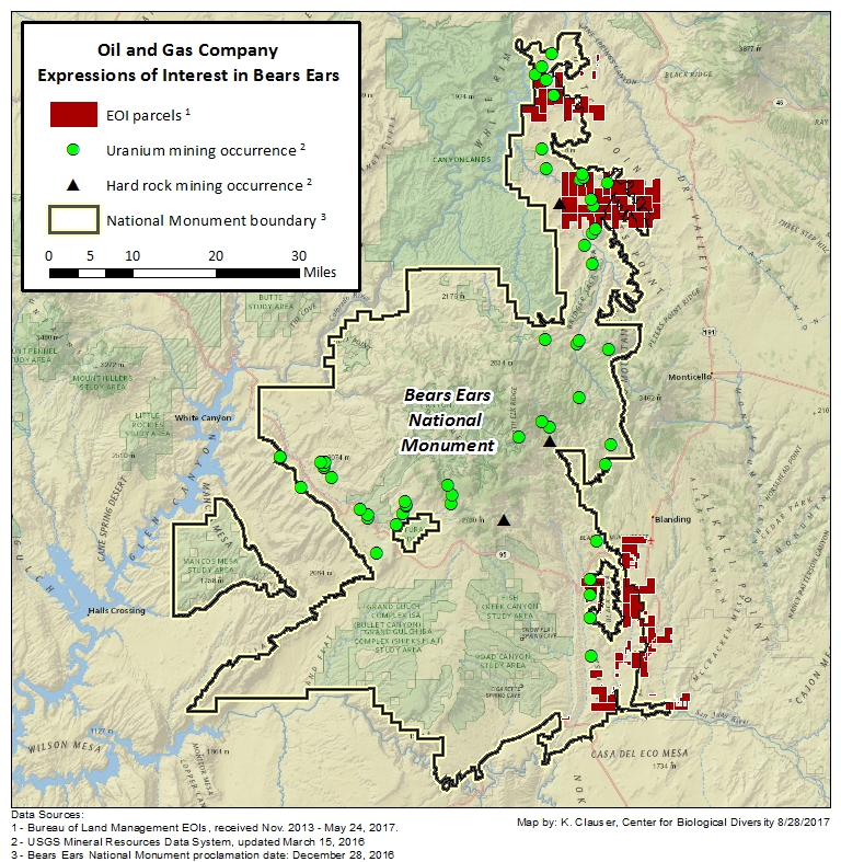
- There have been 287 oil and gas wells drilled in the BENM boundary. All wells have been plugged and abandoned.
- Of those drilled wells, only nine produced oil and six produced gas. 302,027 barrels of oil have been produced with 77 percent of it coming from one well and 94 percent coming from just three wells. These locations were all near each other on the Bluff bench. A total of 204,747 mcf of gas has been produced.
- There has been no production from these wells since 1992. Only the two highest producing wells produced into the 1990s; all others pre-date 1985.
- Most of BENM has low oil and gas potential, except the northeastern and southeastern corners; these areas have moderate oil and gas potential. No APDs (applications for permit to drill) exist within BENM.
The new BENM is generally west of the Paradox Formation subplay areas shown in UGS Bulletin 137 (Major Oil Plays in Utah and Vicinity). BENM barely starts to encroach into the western most parts of these Paradox subplay areas. There are only a few wells in BENM and the western Paradox Basin of southeastern Utah, and thus we have very little data to have extended the subplay areas farther west.
The northern Paradox Basin includes not only the main Cane Creek shale oil Paradox subplay area but it also has potential in the Leadville Limestone play. This region of the Paradox Basin includes Canyonlands and Arches NP, and BENM. However, the main Cane Creek subplay trend is again mainly to the east of BENM, overlapping only in the far northeast corner.
Renewable Resources
- There are no recognized or published wind resources within BENM,
- There are no recognized or published geothermal resources within BENM,
- There is only limited and disjointed land with solar potential in BENM,
- A lack of transmission lines makes renewable development in BENM unlikely.
Coal
There are no coal resources within BENM.
Oil sands
There are two minor oil sand deposits in BENM. Both have very low development potential.
Uranium
Historically, Utah is the third most productive state for uranium in the U.S. with the vast majority of its production from the Colorado Plateau. In the region of BENM, uranium occurs in sandstone-hosted deposits with the associated metals vanadium, copper, and molybdenum. BENM has been productive for uranium deposits in the past, and some of the mining districts within the monument continue to hold some promise for future uranium production. In decreasing order of importance these districts are White Canyon, Elk Ridge, Deer Flat, Indian Creek, and Fry Canyon, which have moderate to low development potential.
Potash
Potash resource potential in BENM is found in the Paradox Formation, which is a thick, cyclic sequence of alternating evaporites (including potash) and other sedimentary rocks. The cycles in the Paradox Formation are numbered sequentially from 1 to 29 and a higher number indicates an older, deeper cycle. In BENM, potash resource potential is located in its northeastern extension. Potash is not currently produced in BENM, but is produced just north of the monument. Based on available data the cycles in the Paradox Formation with the greatest potential in BENM are cycles 13 and 18, but other cycles also have potential. An area of approximately 2200 acres of BENM overlaps with one of the BLM’s known potash leasing areas (KPLA). A KPLA is an area where the BLM has made a determination that valuable potash resources exist.
Salt
Similar to potash, salt (NaCl) potential in the BENM is within the Paradox Formation. Thick salt beds are present in the unit and are interbedded with other evaporitic and sedimentary rocks. Although the extent of salt resource potential extends beyond that of potash potential, salt in the Paradox Basin is likely to only be produced as a byproduct of potash production.
Limestone
Limestone resource potential in BENM is limited. In the south part of the monument, thin limestone layers are found in the Honaker Trail Formation and possibly the Halgaito Formation The limestone in these units is interbedded with other rock types inhibiting the potential for economic extraction. Small volumes of limestone have been produced from these formations outside the southern boundary of BENM. In the northern part of the monument, Cutler Group exposures may contain limestone beds as well. Cutler Group limestone is also likely to be interbedded with other rock types and may be of marginal quality. None of these units present substantive potential for high-calcium limestone.
Sand and Gravel
Known past sand and gravel development in BENM is limited to alluvial deposits around the town of Bluff. Sand and gravel resource potential elsewhere within BENM is also primarily from alluvial deposits along stream channels and drainages. Development potential of these deposits is limited due to the remoteness of the area.
Clay
No clay development or production has occurred in BENM, but some resource potential for common clay and shale, bentonite, and high-alumina clay exists in the area. Because these clay resources do not present a unique resource opportunity and because the resources are remote, development potential for clay resources in BENM is low.