The Utah Geological Survey (UGS) continues to provide emergency response to last Wednesday’s M5.7 earthquake in Magna and is now transitioning into analysis of the collected data. Field reconnaissance of various geologic effects from the earthquake is now finished, unless additional effects are located.
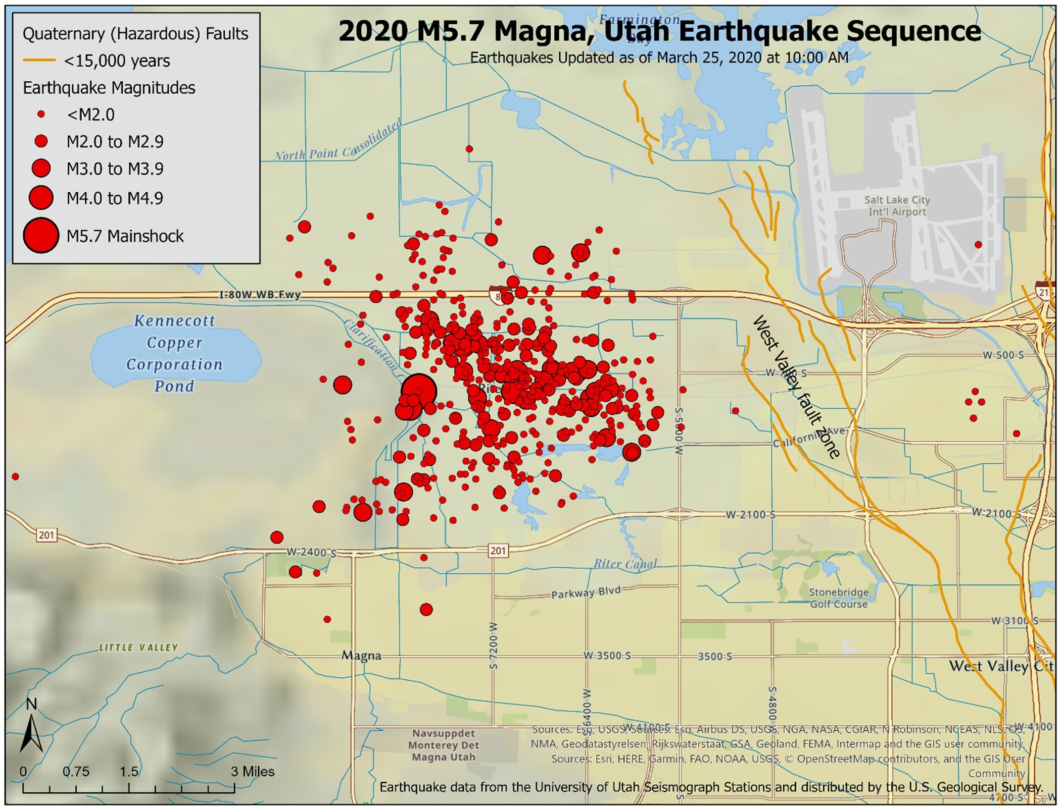
As expected with earthquakes generally less than about magnitude 6.5, no evidence of surface rupture has been found. However, numerous ground cracks, likely from lateral spreading, and sand boil liquefaction features have been observed and documented. The UGS and the University of Utah Seismograph Stations are continuing to investigate which fault the M5.7 earthquake occurred on.
It is very unlikely to have occurred on the West Valley fault zone, as these faults generally dip to the east, away from the earthquake location. As for the aftershock sequence (tables 1 and 2, and figure 3), the number of aftershocks has generally been decreasing since the mainshock on Wednesday, March 18 as expected. Table 2 shows the number of aftershocks per magnitude range. However, we do anticipate that additional aftershocks that can be felt (generally greater than about magnitude 2.5) will continue for days to possibly several weeks.
Click here for a review of the data and findings from this week.