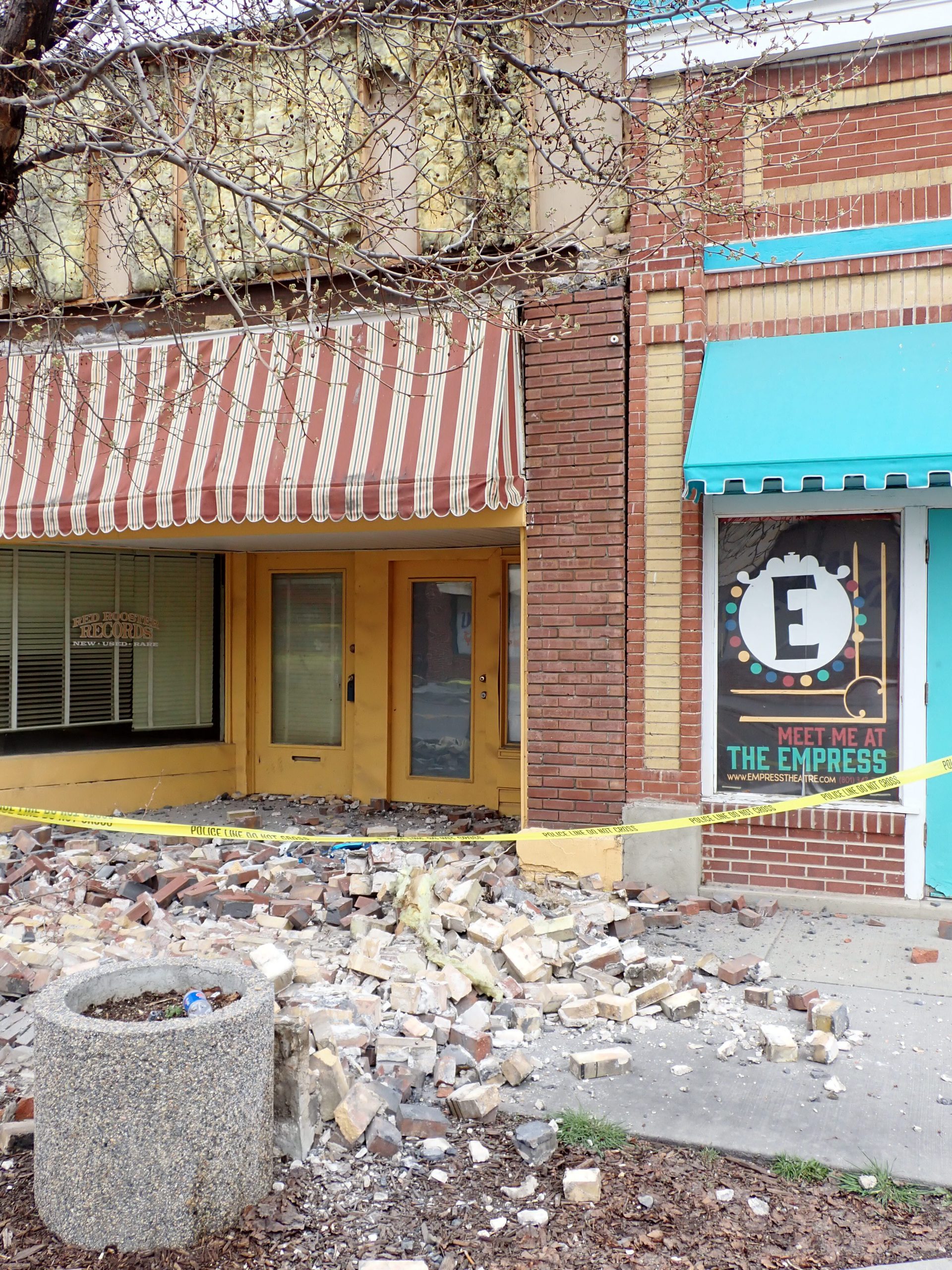
Salt Lake City (March 18, 2020) – The epicenter of this morning’s northern Utah 5.7 magnitude (M) earthquake was north of Magna. As of 4:30 p.m. this afternoon, there had been 90 aftershocks. Additional aftershocks are expected at least over the next few days.
The following bullet points provide additional information from the Utah Geological Survey (UGS) regarding today’s events:
- A digital clearinghouse is available at https://geodata.geology.utah.gov/pages/search.php?search=!collection609 These items are available to anyone. More information will be added as our field teams continue their investigations. Photos are included.
- Of the 90 aftershocks reported at 4:30 p.m., 43 were an M 2.5 or greater. The largest was M 4.6.
- Two field teams of geologists mobilized to look for evidence of surface fault rupture, liquefaction, lateral spread, and other geological effects from the earthquake. This is an ongoing sequence so earthquake effects from aftershocks may not have been reviewed yet.
- Field teams mobilized to the following areas:
- North of Salt Lake International Airport
- Along the Jordan River, east of the airport
- Baileys Lake area
- Along I-80 between the airport and Saltair
- Downtown Magna
- UGS field teams observed minor lateral spread in some minimal areas near the Jordan River. This is where soils can become jelly-like. Lateral spread can occur in areas with shallow groundwater and soils conducive to liquefaction. Monitoring is ongoing, but of minimal concern.
- Field teams also reported damage in the downtown Magna area to unreinforced masonry buildings (URM), and the siding covering a URM.
- UGS field teams will continue tomorrow to monitor aftershocks, and conduct ongoing fieldwork along the east bench of Salt Lake County looking for rockfalls.
Additional Resources
- Earthquake and Fault Information
- Utah Preparedness Information
- Real-Time Earthquake Information
- Earthquake Digital Clearinghouse
- Historical Aerial Photography